Salt Haven
Introduction
The photograph on this page of Salt Haven by Simon Carey as part of the Geograph project.
The Geograph project started in 2005 with the aim of publishing, organising and preserving representative images for every square kilometre of Great Britain, Ireland and the Isle of Man.

There are currently over 7.5m images from over 14,400 individuals and you can help contribute to the project by visiting https://www.geograph.org.uk
Salt Haven
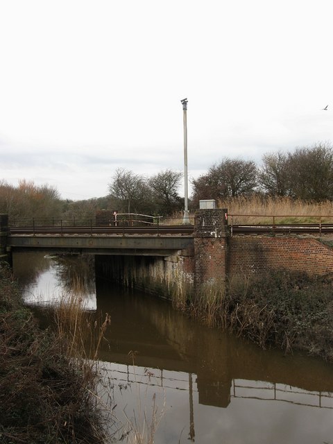
Image: © Simon Carey Taken: 24 Jan 2010
The name of the waterway south of Pevensey Bridge which is known as Pevensey Haven to the north. This was an outlet to the sea until the mid 17th century when sluice gates were added near the beach which meant boats were no longer able to navigate the waterway. Today it is the main drain for the western side of Pevensey Levels. The bridge carries the East Coastway line over the waterway next to Wallsend level crossing which explains the presence of the CCTV camera.
Images are licensed for reuse under creativecommons.org/licenses/by-sa/2.0
Image Location
Latitude
50.817738
Longitude
0.344241