Kendal roofscape
Introduction
The photograph on this page of Kendal roofscape by Humphrey Bolton as part of the Geograph project.
The Geograph project started in 2005 with the aim of publishing, organising and preserving representative images for every square kilometre of Great Britain, Ireland and the Isle of Man.

There are currently over 7.5m images from over 14,400 individuals and you can help contribute to the project by visiting https://www.geograph.org.uk
Kendal roofscape
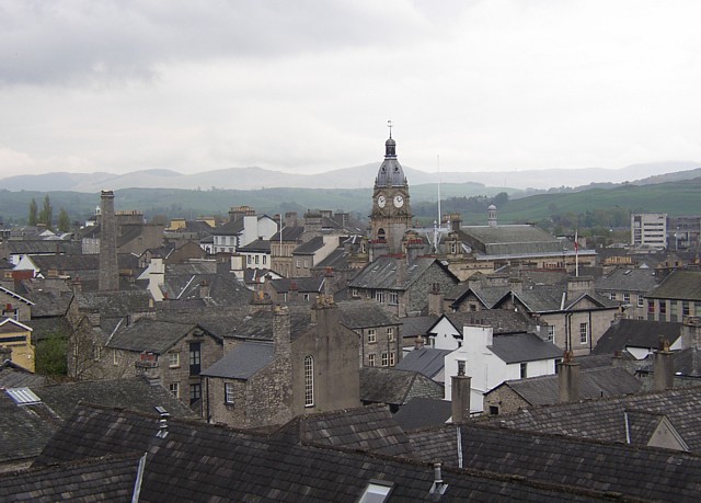
Image: © Humphrey Bolton Taken: 7 May 2006
The buildings of Kendal, especially on the west side of the main street, are very tightly packed, with access from narrow 'yards', many with no name but identified by numbers. The two prominent features are the chimney of the former public baths and the tower of the Town Hall.
Images are licensed for reuse under creativecommons.org/licenses/by-sa/2.0
Image Location
Latitude
54.325747
Longitude
-2.748758