Evidence of abandoned canal, Yates Avenue, Rugby (1)
Introduction
The photograph on this page of Evidence of abandoned canal, Yates Avenue, Rugby (1) by Andy F as part of the Geograph project.
The Geograph project started in 2005 with the aim of publishing, organising and preserving representative images for every square kilometre of Great Britain, Ireland and the Isle of Man.

There are currently over 7.5m images from over 14,400 individuals and you can help contribute to the project by visiting https://www.geograph.org.uk
Evidence of abandoned canal, Yates Avenue, Rugby (1)
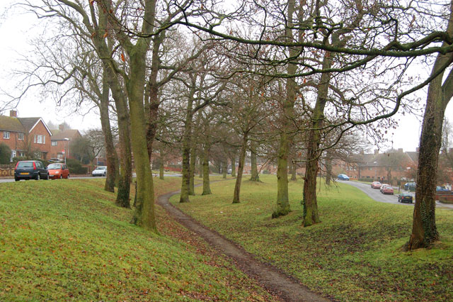
Image: © Andy F Taken: 18 Jan 2010
Yates Avenue is built on the long-disused original route of the Oxford Canal. The depression between the two tree-lined embankments marks the course of the abandoned waterway. This section of the canal was bypassed by a more direct route in the nineteenth century.
Images are licensed for reuse under creativecommons.org/licenses/by-sa/2.0
Image Location


Leaflet Map data © OpenStreetMap
Latitude
52.385447
Longitude
-1.270315