Con O'Neill's bridge, Belfast
Introduction
The photograph on this page of Con O'Neill's bridge, Belfast by Albert Bridge as part of the Geograph project.
The Geograph project started in 2005 with the aim of publishing, organising and preserving representative images for every square kilometre of Great Britain, Ireland and the Isle of Man.

There are currently over 7.5m images from over 14,400 individuals and you can help contribute to the project by visiting https://www.geograph.org.uk
Con O'Neill's bridge, Belfast
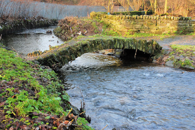
Image: © Albert Bridge Taken: 25 Jan 2010
Reputedly the oldest surviving structure in Belfast. Built on what were the lands of Con O’Neill, a 16th Irishman who owned much of east Ulster (later lost to Scottish settlers). Described (in 1967) by Charles Brett as “a hoop of ancient stonework crumbling shamefully at the foot of a pylon in the derelict wasteland behind Abetta Parade” – nothing has changed . . . . (Still in use by the way). Image (October 2012) shows the bridge, partly-submerged, after heavy overnight rain. Image shows the bridge after completion of restoration etc under the Connswater Greenway scheme.
Images are licensed for reuse under creativecommons.org/licenses/by-sa/2.0
Image Location
Latitude
54.590746
Longitude
-5.887549