May's Meadow, Belfast (1)
Introduction
The photograph on this page of May's Meadow, Belfast (1) by Albert Bridge as part of the Geograph project.
The Geograph project started in 2005 with the aim of publishing, organising and preserving representative images for every square kilometre of Great Britain, Ireland and the Isle of Man.

There are currently over 7.5m images from over 14,400 individuals and you can help contribute to the project by visiting https://www.geograph.org.uk
May's Meadow, Belfast (1)
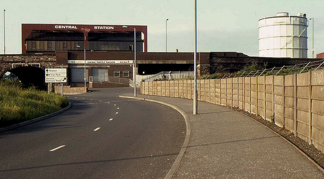
Image: © Albert Bridge Taken: 21 Jun 1983
No longer the meadow where cattle were kept before sale at the nearby market, May’s Meadow runs from the Laganbank Road to East Bridge Street via a tunnel (Image middle left) close to Central station. The station (top left) was in its original form Image The gasworks can be seen at upper right – now closed and redeveloped (after extensive decontamination) Image The railway is behind the concrete fence (right). For the 2010 view see Image
Images are licensed for reuse under creativecommons.org/licenses/by-sa/2.0
Image Location
Latitude
54.596468
Longitude
-5.916963