Disused railway line south east of Chorlton Junction
Introduction
The photograph on this page of Disused railway line south east of Chorlton Junction by Phil Champion as part of the Geograph project.
The Geograph project started in 2005 with the aim of publishing, organising and preserving representative images for every square kilometre of Great Britain, Ireland and the Isle of Man.

There are currently over 7.5m images from over 14,400 individuals and you can help contribute to the project by visiting https://www.geograph.org.uk
Disused railway line south east of Chorlton Junction
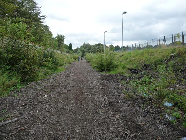
Image: © Phil Champion Taken: 29 Aug 2009
This was the trackbed of the former Midland Railway's Manchester South District Line from Manchester Central towards Tiviot Dale. The section from Chorlton Junction closed in the 1960s. Since this photo was taken the section of line seen here has been re-opened as part of the Metrolink tram network. Phase 3a of the expansion plans included development of the South Manchester line as far as the new St Werburgh's Road station. The photographer's location is roughly in the vicinity of where the ramp from the island platform now stands, at the east end of the station. Tracks have been laid almost to the bridge carrying Mauldeth Road West over the line, with a head-shunt and points to allow trams to change tracks. As part of Phase 3b, work is ongoing to extend the line towards Didsbury, with a another extension towards Manchester Airport, the junction being near Mauldeth Road West.
Images are licensed for reuse under creativecommons.org/licenses/by-sa/2.0
Image Location
Latitude
53.438432
Longitude
-2.2649