House in Kirby Underdale
Introduction
The photograph on this page of House in Kirby Underdale by Michael Jagger as part of the Geograph project.
The Geograph project started in 2005 with the aim of publishing, organising and preserving representative images for every square kilometre of Great Britain, Ireland and the Isle of Man.

There are currently over 7.5m images from over 14,400 individuals and you can help contribute to the project by visiting https://www.geograph.org.uk
House in Kirby Underdale
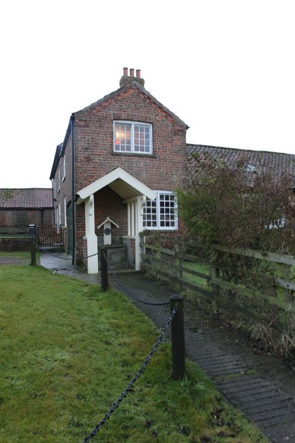
Image: © Michael Jagger Taken: 24 Jan 2010
The annex to the house looks like an old well, for villagers to get their water from, before mains water was provided, however I can't find any reference to this on the Ordnance Survey map. An update I have received recently (Feb 2010): it looks like a water pillar, not a pump. These were the successors to village pumps, and were connected to the water mains, delivering water under pressure. In fact, a tap. Which were replaced by domestic taps in each house. For more details see: www.villagepumps.org.uk
Images are licensed for reuse under creativecommons.org/licenses/by-sa/2.0
Image Location
Latitude
54.016833
Longitude
-0.76926