
Ryelands Road - Lancaster
Introduction
The photograph on this page of Ryelands Road - Lancaster by Tom Howard as part of the Geograph project.
The Geograph project started in 2005 with the aim of publishing, organising and preserving representative images for every square kilometre of Great Britain, Ireland and the Isle of Man.

There are currently over 7.5m images from over 14,400 individuals and you can help contribute to the project by visiting https://www.geograph.org.uk
Ryelands Road - Lancaster
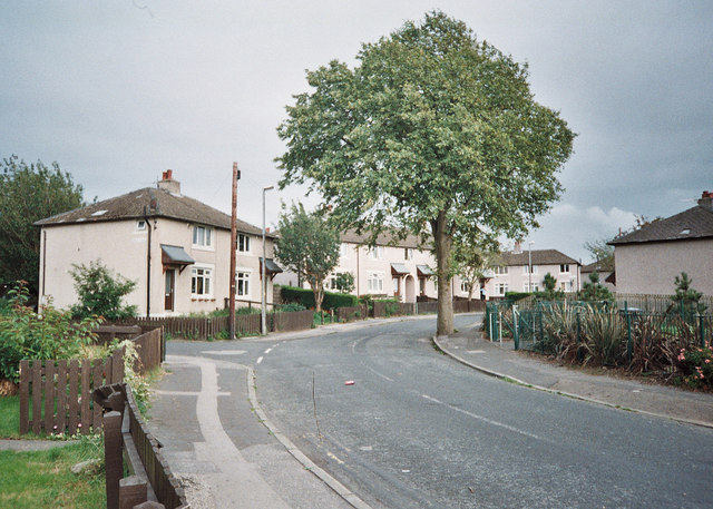
Image: © Tom Howard Taken: Unknown
Seen here is a part of Ryelands Road that was known as the 'Bull Ring' because the road in this area of the 1930s Council Estate was oval. Quite a number of the houses have been demolished giving parts of Ryelands Estate open areas in a radical plan of recent years. The junction on the left is the cul-de-sac of Artle Place, which is named after Artle Beck in the Lune valley. Artle Beck flows into the south bank of the River Lune four and one fifth of a mile east as the crow flies, near the village of Caton. Indeed I was happy to discover as a boy that the place names on Ryelands were named after beautiful valleys and fells etc in NW Lancashire. Wonderful places that I would visit on my push bike in late boyhood and early teens.
Images are licensed for reuse under creativecommons.org/licenses/by-sa/2.0
Image Location

Latitude
54.056979
Longitude
-2.810215