End of the Fallowfield Loop Cycleway
Introduction
The photograph on this page of End of the Fallowfield Loop Cycleway by Phil Champion as part of the Geograph project.
The Geograph project started in 2005 with the aim of publishing, organising and preserving representative images for every square kilometre of Great Britain, Ireland and the Isle of Man.

There are currently over 7.5m images from over 14,400 individuals and you can help contribute to the project by visiting https://www.geograph.org.uk
End of the Fallowfield Loop Cycleway
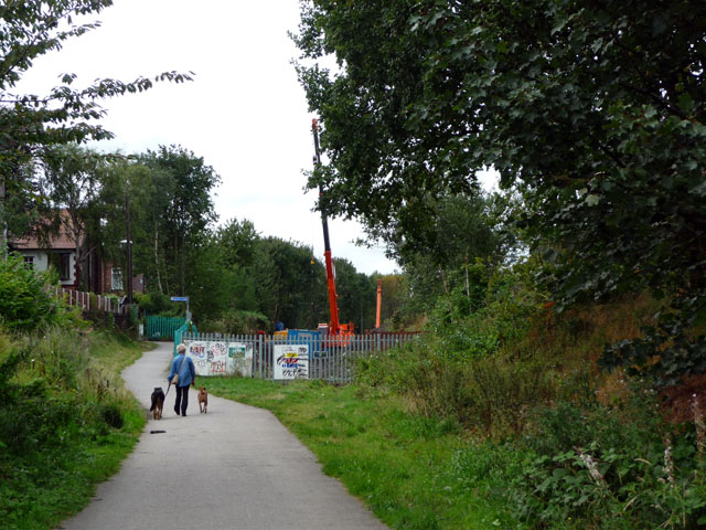
Image: © Phil Champion Taken: 29 Aug 2009
The disused Fallowfield Loop railway line and a short section of the South District Line west of St Werburgh's Road (seen here) were converted into a cycle path in the 1990. This was the final section linking to the end of Sidbury Road. By summer 2009 work was well under way to re-open the line from Old Trafford to Chorlton Junction as an extension to the Metrolink tram network. The cranes visible in the photo were being used by a piling contractor. The line re-opened on the 7th July 2011. The cycle path has been realigned to cross the track via a level crossing and run along the north side as far as the new St Werburgh's Road stop.
Images are licensed for reuse under creativecommons.org/licenses/by-sa/2.0
Image Location
Latitude
53.439772
Longitude
-2.268371