Control line flying on Sax Rec, about 1966
Introduction
The photograph on this page of Control line flying on Sax Rec, about 1966 by John Goldsmith as part of the Geograph project.
The Geograph project started in 2005 with the aim of publishing, organising and preserving representative images for every square kilometre of Great Britain, Ireland and the Isle of Man.

There are currently over 7.5m images from over 14,400 individuals and you can help contribute to the project by visiting https://www.geograph.org.uk
Control line flying on Sax Rec, about 1966
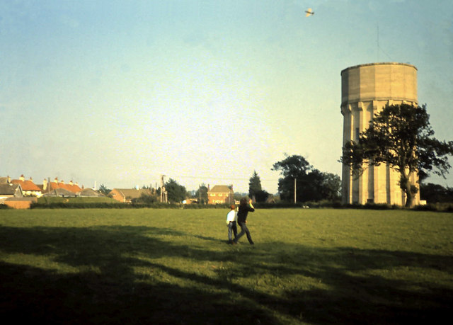
Image: © John Goldsmith Taken: Unknown
It is about 1966 and Wayne and Derek are flying control line combat on the Saxmundham Recreation ground, now known as Memorial Field. Only one of the two planes is visible in this shot, and that does not have the streamer that it should be towing. The water tower features in countless Geograph photos, but I remember it as an obstruction to our (supposedly!) radio controlled aircraft. In more modern photos you will see a scout hut in the corner of the field nearest the tower.
Images are licensed for reuse under creativecommons.org/licenses/by-sa/2.0
Image Location
Latitude
52.214474
Longitude
1.480028