Chapelfield Road Methodist, Norwich
Introduction
The photograph on this page of Chapelfield Road Methodist, Norwich by Graham Hardy as part of the Geograph project.
The Geograph project started in 2005 with the aim of publishing, organising and preserving representative images for every square kilometre of Great Britain, Ireland and the Isle of Man.

There are currently over 7.5m images from over 14,400 individuals and you can help contribute to the project by visiting https://www.geograph.org.uk
Chapelfield Road Methodist, Norwich
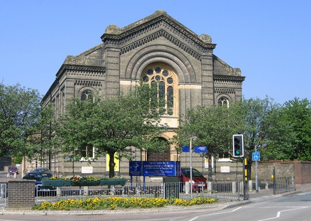
Image: © Graham Hardy Taken: 10 May 2006
Chapelfield Road Methodist Church is located on Norwich's inner ring road, close to St Stephen's roundabout. It was opened in 1881, and built to seat almost 1,000 worshippers, its impressive frontage has remained unaltered although there have been considerable changes behind it, see church website www.chapelfieldroadmethodist.org.uk/
Images are licensed for reuse under creativecommons.org/licenses/by-sa/2.0
Image Location
Latitude
52.624512
Longitude
1.288591