Arnold Circus
Introduction
The photograph on this page of Arnold Circus by Alan Simkins as part of the Geograph project.
The Geograph project started in 2005 with the aim of publishing, organising and preserving representative images for every square kilometre of Great Britain, Ireland and the Isle of Man.

There are currently over 7.5m images from over 14,400 individuals and you can help contribute to the project by visiting https://www.geograph.org.uk
Arnold Circus
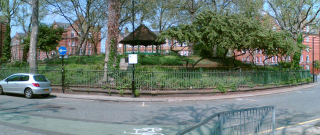
Image: © Alan Simkins Taken: 10 May 2006
The bandstand on Arnold Circus, in the Boundary Estate. Looking north from Club Row. From Wikipedia: The Boundary Estate is a housing development, formally opened in 1900, in the East End of London, England. The estate, constructed from 1890, was one of the earliest social housing schemes, and was built by the London County Council as the world's first council housing, replacing the Friars Mount slum, the rubble of which was used to construct a mound in the middle of Arnold Circus at the centre of the development, housing a still extant bandstand. The estate consists of multi-storey brick structures, surrounding the central mound.
Images are licensed for reuse under creativecommons.org/licenses/by-sa/2.0
Image Location
Latitude
51.525618
Longitude
-0.07557