North end of Coulsdon Bypass
Introduction
The photograph on this page of North end of Coulsdon Bypass by Dr Neil Clifton as part of the Geograph project.
The Geograph project started in 2005 with the aim of publishing, organising and preserving representative images for every square kilometre of Great Britain, Ireland and the Isle of Man.

There are currently over 7.5m images from over 14,400 individuals and you can help contribute to the project by visiting https://www.geograph.org.uk
North end of Coulsdon Bypass
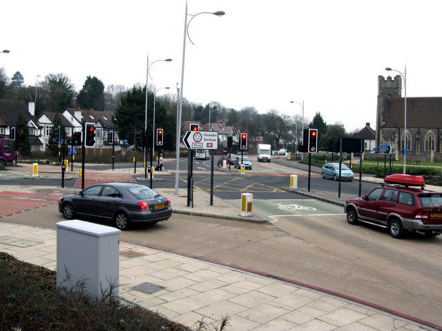
Image: © Dr Neil Clifton Taken: 21 Jan 2010
About two years ago, this bypass opened for traffic. The northern junction with the A23 has not proved very successful. On Monday 25 January 2010 work will begin to alter this junction, so these photographs are designed to record the appearance of the junction before work begins. This is looking north towards the existing A23. The bypass is behind the camera to the right. Methodist Church of the right.
Images are licensed for reuse under creativecommons.org/licenses/by-sa/2.0
Image Location
Latitude
51.322457
Longitude
-0.135753