Hemel Hempstead: The Magic Roundabout
Introduction
The photograph on this page of Hemel Hempstead: The Magic Roundabout by Nigel Cox as part of the Geograph project.
The Geograph project started in 2005 with the aim of publishing, organising and preserving representative images for every square kilometre of Great Britain, Ireland and the Isle of Man.

There are currently over 7.5m images from over 14,400 individuals and you can help contribute to the project by visiting https://www.geograph.org.uk
Hemel Hempstead: The Magic Roundabout
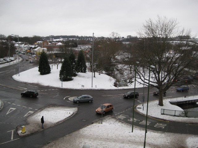
Image: © Nigel Cox Taken: 10 Jan 2010
Hemel's Magic Roundabout was constructed in 1973, a year after its counterpart in Swindon. It is formally known as The Plough Roundabout or Moor End Roundabout. Despite their reputation these roundabouts work well and it is doubtful if any driver using them regularly would think twice about them. The River Gade flows through the middle. This is an accidental retake from the same viewpoint of Giles' Image The one major change that seems to have taken place is the reconfiguration of the junction arrangements with the road bottom right.
Images are licensed for reuse under creativecommons.org/licenses/by-sa/2.0
Image Location
Latitude
51.746101
Longitude
-0.472831