Cross at Carnteel
Introduction
The photograph on this page of Cross at Carnteel by Kenneth Allen as part of the Geograph project.
The Geograph project started in 2005 with the aim of publishing, organising and preserving representative images for every square kilometre of Great Britain, Ireland and the Isle of Man.

There are currently over 7.5m images from over 14,400 individuals and you can help contribute to the project by visiting https://www.geograph.org.uk
Cross at Carnteel
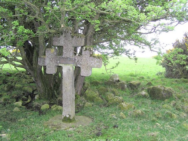
Image: © Kenneth Allen Taken: 9 May 2006
This cross is most unusual, I last saw it over 40 years ago when I visited my uncle's farm, in fact I had forgotten where it was and had to get him to take me to it. It is located at the top of a hill above the farm, now owned by my cousin, to the south of Carnteel and is partly hidden by whin bushes. There is an inscription at the centre which reads, "Spero Meliora, This cross marks the place where Rev Dr. C.K.S. Moffatt was called by God to preach the gospel, 3rd October, 1924" He preached in America and when he returned on vacation, he made the cross out of reinforced concrete and hauled it up the field with a horse drawn sled. A testomony to its lasting construction is that the bush is heavy and is constantly being blown against it. The ancient monument authority was contacted about preserving it, but they said that it wasn't old enough to be important. http://www.geograph.org.uk/photo/166679
Images are licensed for reuse under creativecommons.org/licenses/by-sa/2.0
Image Location
Latitude
54.426176
Longitude
-6.925332