Aerial view of Kingsley Lane and Sandown Road, Thundersley
Introduction
The photograph on this page of Aerial view of Kingsley Lane and Sandown Road, Thundersley by Edward Clack as part of the Geograph project.
The Geograph project started in 2005 with the aim of publishing, organising and preserving representative images for every square kilometre of Great Britain, Ireland and the Isle of Man.

There are currently over 7.5m images from over 14,400 individuals and you can help contribute to the project by visiting https://www.geograph.org.uk
Aerial view of Kingsley Lane and Sandown Road, Thundersley
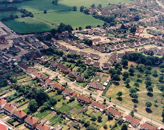
Image: © Edward Clack Taken: 5 Jun 1987
These two roads run off the Rayleigh Road (A129) just south of the Rayleigh Weir. The Rayleigh Road runs from left to right along the top of the picture. Kingsley Lane runs from the centre-left to the lower right. Sandown Road comes off the Rayleigh Road opposite the fields, runs towards then centre, then bends up towards the upper right. The parkland with scattered trees at the right is the northern end of Thundersley Common.
Images are licensed for reuse under creativecommons.org/licenses/by-sa/2.0
Image Location
Latitude
51.575646
Longitude
0.595206