Plaque, National Cycle Network, route 73
Introduction
The photograph on this page of Plaque, National Cycle Network, route 73 by Richard Webb as part of the Geograph project.
The Geograph project started in 2005 with the aim of publishing, organising and preserving representative images for every square kilometre of Great Britain, Ireland and the Isle of Man.

There are currently over 7.5m images from over 14,400 individuals and you can help contribute to the project by visiting https://www.geograph.org.uk
Plaque, National Cycle Network, route 73
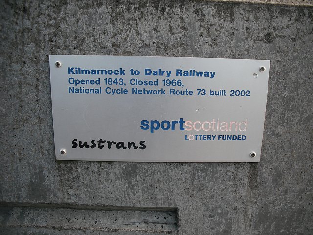
Image: © Richard Webb Taken: 9 Sep 2009
Celebrating the conversion of a length of the Glasgow, Paisley, Kilmarnock and Ayr Railway into a cycle path. The railway was still shown on maps in 1976, and closed to passenger traffic along with the Kilbarchan Loop in 1966.
Images are licensed for reuse under creativecommons.org/licenses/by-sa/2.0
Image Location
Latitude
55.616217
Longitude
-4.511762