
The Brasher Bridge
Introduction
The photograph on this page of The Brasher Bridge by Lairich Rig as part of the Geograph project.
The Geograph project started in 2005 with the aim of publishing, organising and preserving representative images for every square kilometre of Great Britain, Ireland and the Isle of Man.

There are currently over 7.5m images from over 14,400 individuals and you can help contribute to the project by visiting https://www.geograph.org.uk
The Brasher Bridge
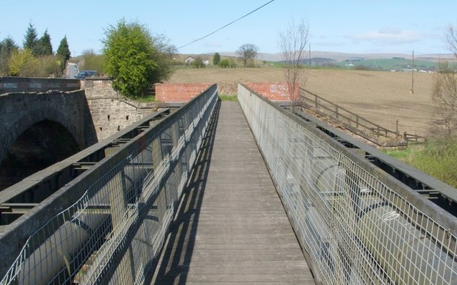
Image: © Lairich Rig Taken: 28 Apr 2006
The title refers to the wooden footbridge, whose construction was partly funded by the Chris Brasher Trust, and not to the road bridge to which it runs parallel; the latter is Image For an explanation of the pipes that can be seen alongside the footbridge, see Image, which is a view in the opposite direction. In the distance, beyond and a little to the left of the far end of the footbridge, is Summerston Farm (on the OS maps, its name has been displaced to above East Millichen Farm). The course of the Antonine Wall runs across the field, and through the location of the farm, and there was also a Roman Fort at Balmuildy. However, I don't believe that there are any particularly visible remains in this area; traces, if any, must be fairly indistinct.
Images are licensed for reuse under creativecommons.org/licenses/by-sa/2.0
Image Location

Latitude
55.91879
Longitude
-4.274423