Helen's Bay station (8)
Introduction
The photograph on this page of Helen's Bay station (8) by Albert Bridge as part of the Geograph project.
The Geograph project started in 2005 with the aim of publishing, organising and preserving representative images for every square kilometre of Great Britain, Ireland and the Isle of Man.

There are currently over 7.5m images from over 14,400 individuals and you can help contribute to the project by visiting https://www.geograph.org.uk
Helen's Bay station (8)
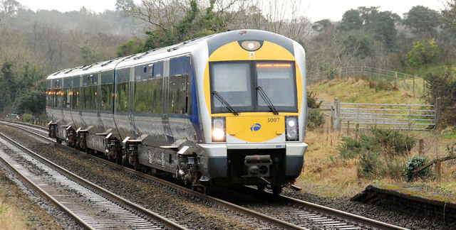
Image: © Albert Bridge Taken: 15 Jan 2010
See Image The 14.27 Bangor – Portadown approaching Helen’s Bay station. The remains of the old (longer and lower) up platform can be seen at bottom right. Another one spot on time.
Images are licensed for reuse under creativecommons.org/licenses/by-sa/2.0
Image Location
Latitude
54.665597
Longitude
-5.738575