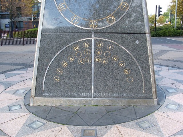
Pyramidal Clock sculpture (detail)
Introduction
The photograph on this page of Pyramidal Clock sculpture (detail) by Lairich Rig as part of the Geograph project.
The Geograph project started in 2005 with the aim of publishing, organising and preserving representative images for every square kilometre of Great Britain, Ireland and the Isle of Man.
There are currently over 7.5m images from over 14,400 individuals and you can help contribute to the project by visiting https://www.geograph.org.uk

Image: © Lairich Rig Taken: 23 Sep 2005
For a view of the sculpture as a whole, see Image This is the base on the southern side. The three sides each bear the text "what time is now – time", but it is represented in Braille and in sign-language on the other two sides. Above the text on each side is a ring of twelve figures (on this side, these are mostly the old planetary symbols — by which I mean the alchemical symbols for the planets), with constellations depicted in the space within. The text at the bottom of the sculpture, on this side, reads (between the names of the sculptors): 55°47´N 4°25´W CAELUM NOCTIS S I.I.MM 00.01G.M.T. Apart from the latitude and longitude, this line, presumably referring to the star chart within the ring, is to be interpreted as "the night sky, [when looking] south, on January 1st, 2000, at 00:01 GMT". The S (south) is replaced by WNW and ENE on the other two sides; as well as applying to the star charts, it indicates the direction faced by each side of the sculpture. [In this inscription, the Latin word "caelum" means "sky"; however, it is also the (Latin) name of a southern constellation, one that is never visible from here. The constellation name Caelum means "chisel"; the two Latin words, though identical in spelling, are unrelated.]

