Well house and water conduit, Woodbury Salterton
Introduction
The photograph on this page of Well house and water conduit, Woodbury Salterton by Derek Harper as part of the Geograph project.
The Geograph project started in 2005 with the aim of publishing, organising and preserving representative images for every square kilometre of Great Britain, Ireland and the Isle of Man.

There are currently over 7.5m images from over 14,400 individuals and you can help contribute to the project by visiting https://www.geograph.org.uk
Well house and water conduit, Woodbury Salterton
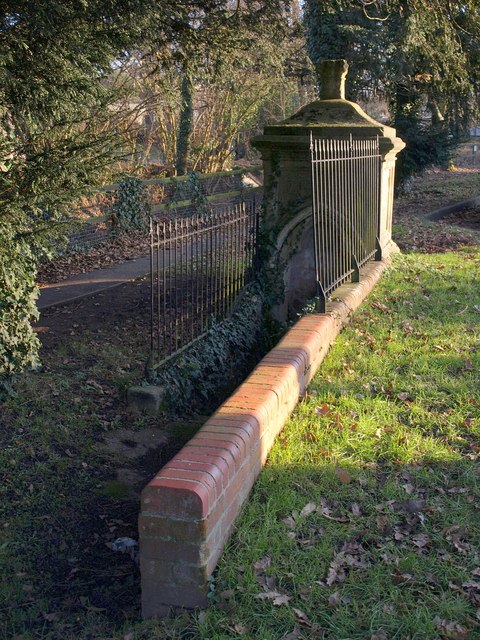
Image: © Derek Harper Taken: 4 Jan 2010
Above a duck-filled stream on Village Road. Dating from about 1847, the well house rather resembles an ornate altar tomb with its moulded finial. Around the water outlet at this northern side is an arch, the inner part of which is trefoil-shaped. "In 1832 Woodbury Salterton was struck by a cholera epidemic; Marianne Pidsley put a series of improvements in hand" http://www.imagesofengland.org.uk/Details/Default.aspx?id=88659&mode=adv .
Images are licensed for reuse under creativecommons.org/licenses/by-sa/2.0
Image Location
Latitude
50.691346
Longitude
-3.398833