St Mary's Court
Introduction
The photograph on this page of St Mary's Court by David Anstiss as part of the Geograph project.
The Geograph project started in 2005 with the aim of publishing, organising and preserving representative images for every square kilometre of Great Britain, Ireland and the Isle of Man.

There are currently over 7.5m images from over 14,400 individuals and you can help contribute to the project by visiting https://www.geograph.org.uk
St Mary's Court
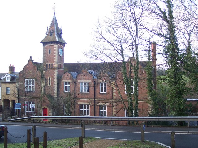
Image: © David Anstiss Taken: 3 Jan 2010
This used to be Lamberhurst Old School on Parsonage Lane. Seen from the Broadway. It was built in 1836 in the Jacobean Period. Extended in 1850, when the tower was added and a weathervane was made by a local blacksmith. The tower was later heightened to accommodate the 'Village Clock' dated 1863. It was later used as a school hall, but then sold to developers. Now converted into apartments.
Images are licensed for reuse under creativecommons.org/licenses/by-sa/2.0
Image Location
Latitude
51.103547
Longitude
0.393815