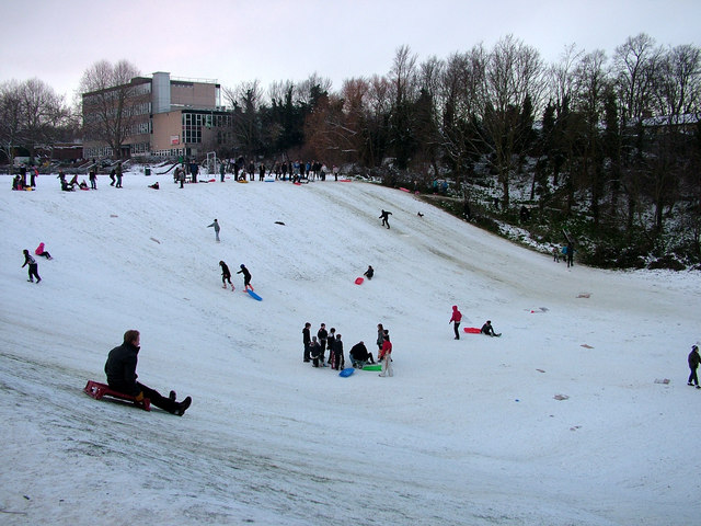
Sledging at St. Peter's Pit
Introduction
The photograph on this page of Sledging at St. Peter's Pit by John Goldsmith as part of the Geograph project.
The Geograph project started in 2005 with the aim of publishing, organising and preserving representative images for every square kilometre of Great Britain, Ireland and the Isle of Man.
There are currently over 7.5m images from over 14,400 individuals and you can help contribute to the project by visiting https://www.geograph.org.uk

Image: © John Goldsmith Taken: 8 Jan 2010
This is the favourite sledging spot for Bury St. Edmunds - one of the few steep slopes with public access. St. Peter's pit is basically rectangular, but a fenced off private site occupies one side, and another side is lightly wooded. Despite the use of two routes at right angles there are few collisions. The fence acts as a final stop, and depending on footwear can provide a necessary help on the return climb. As well as plastic, wooden and metal runner sledges, improvised versions included carpet squares, plastic bags (including one girl wearing one like a short skirt), a tarpaulin with 7 riders, a blow-up jetski, crates fixed to real skis, skateboards with wheels removed, surf boards, and the rather unsuccessful bread tray visible here (It's the wrong way round you idiot). What a brilliant way for children to get serious exercise and to very clearly enjoy it. And a great way to socialise. Houses in Grove Park and the West Suffolk College can be seen behind.

