Hangleton
Introduction
The photograph on this page of Hangleton by Simon Carey as part of the Geograph project.
The Geograph project started in 2005 with the aim of publishing, organising and preserving representative images for every square kilometre of Great Britain, Ireland and the Isle of Man.

There are currently over 7.5m images from over 14,400 individuals and you can help contribute to the project by visiting https://www.geograph.org.uk
Hangleton
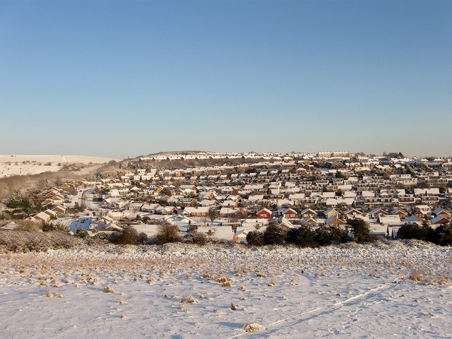
Image: © Simon Carey Taken: 7 Jan 2010
A view of the suburb from Benfield Valley Golf Course. The original settlement of Hangleton was deserted in the middle ages leaving just the church, manor and a few isolated farms in the area, Many of the latter failed in the interwar years and often the lure of property developers' money proved irresistible to the struggling farmers with the result that suburbs such as Hangleton began appearing on the eve of World War Two. Much of the valley below was completed post 1945 specifically in the 1960s and 70s when the last fields disappeared for good.
Images are licensed for reuse under creativecommons.org/licenses/by-sa/2.0
Image Location
Latitude
50.852995
Longitude
-0.203123