Wilbury Lawn, Wilbury Road
Introduction
The photograph on this page of Wilbury Lawn, Wilbury Road by Simon Carey as part of the Geograph project.
The Geograph project started in 2005 with the aim of publishing, organising and preserving representative images for every square kilometre of Great Britain, Ireland and the Isle of Man.

There are currently over 7.5m images from over 14,400 individuals and you can help contribute to the project by visiting https://www.geograph.org.uk
Wilbury Lawn, Wilbury Road
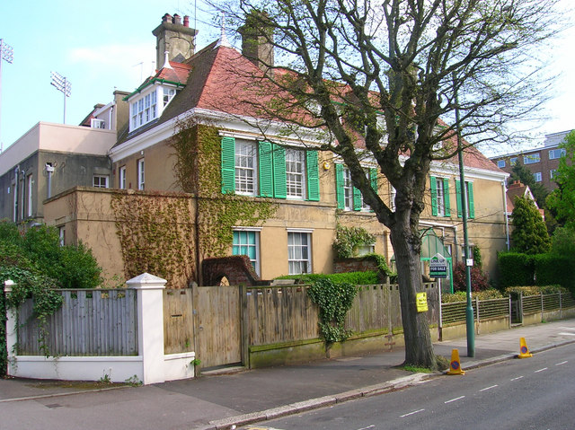
Image: © Simon Carey Taken: 7 May 2006
Built in 1907 in the style of a French Chateau. Today the house has been extended and subdivided into flats. The south west floodlights of Sussex's County Ground can be seen in the background.
Images are licensed for reuse under creativecommons.org/licenses/by-sa/2.0
Image Location
Latitude
50.830126
Longitude
-0.166797