Castle Keep, Newcastle
Introduction
The photograph on this page of Castle Keep, Newcastle by Andrew Curtis as part of the Geograph project.
The Geograph project started in 2005 with the aim of publishing, organising and preserving representative images for every square kilometre of Great Britain, Ireland and the Isle of Man.

There are currently over 7.5m images from over 14,400 individuals and you can help contribute to the project by visiting https://www.geograph.org.uk
Castle Keep, Newcastle
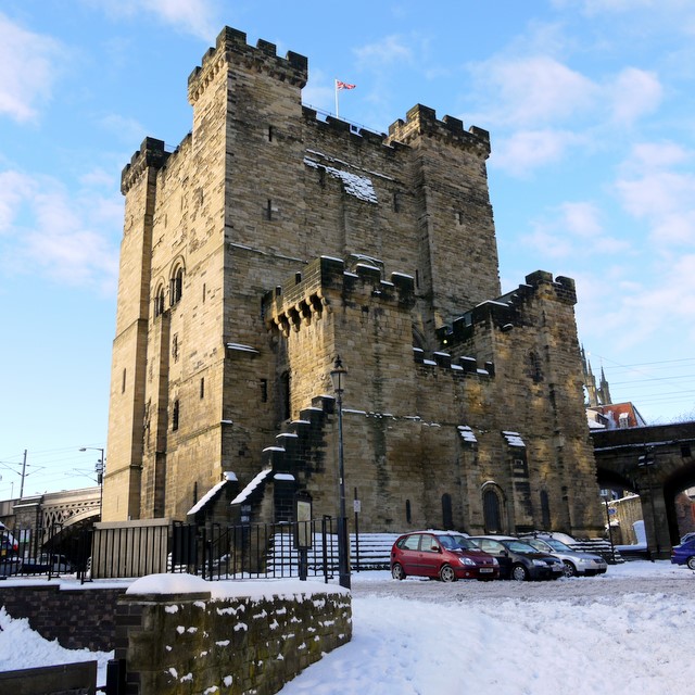
Image: © Andrew Curtis Taken: 7 Jan 2010
The Keep on Castle Garth dates from C12 to C13. Many of the walls of the castle were lost when the railway viaduct was built between the Keep and the Black Gate Image These are visible behind. Views from the roof of the tower can be superb Image
Images are licensed for reuse under creativecommons.org/licenses/by-sa/2.0
Image Location
Latitude
54.968738
Longitude
-1.610404