Ballards Lane
Introduction
The photograph on this page of Ballards Lane by Martin Addison as part of the Geograph project.
The Geograph project started in 2005 with the aim of publishing, organising and preserving representative images for every square kilometre of Great Britain, Ireland and the Isle of Man.

There are currently over 7.5m images from over 14,400 individuals and you can help contribute to the project by visiting https://www.geograph.org.uk
Ballards Lane
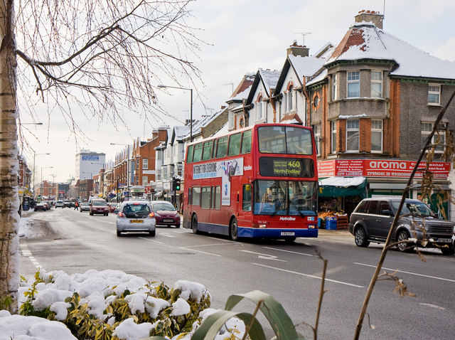
Image: © Martin Addison Taken: 7 Jan 2010
Effectively the 'high street' of Finchley Central or Church End as it is known to the locals. A 460 bus passes the junction with Long Lane and Cornwall Avenue. The white office block in the distance is Central House. The corner shops of the closest block used to have an ornamental 'howdah' on top of the conical roof but these were removed some years ago for safety reasons. The evergreen plants and Silver Birch in the foreground are growing in a raised planting area.
Images are licensed for reuse under creativecommons.org/licenses/by-sa/2.0
Image Location
Latitude
51.60458
Longitude
-0.18906