
Friar House, Clavering Place
Introduction
The photograph on this page of Friar House, Clavering Place by Andrew Curtis as part of the Geograph project.
The Geograph project started in 2005 with the aim of publishing, organising and preserving representative images for every square kilometre of Great Britain, Ireland and the Isle of Man.

There are currently over 7.5m images from over 14,400 individuals and you can help contribute to the project by visiting https://www.geograph.org.uk
Friar House, Clavering Place
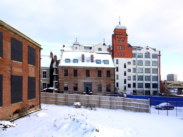
Image: © Andrew Curtis Taken: 7 Jan 2010
The old building in the centre of this development area around Clavering Place is Friar House, a Grade II listed, 18th century, Georgian town-house. This is being renovated to become Saints Hotel incorporating a boutique, bar, bistro, cafe and 200 bed hotel. A walled garden is planned at the front. The rear of the Turnbull Building is behind with its distinctive, domed tower to the right. The front of this building is shown here Image The High Level Bridge can be seen to the right. Clavering House is to the left of Friar House, while in the foreground on the left, is part of the old chapel building that is in the process of redevelopment which will incorporate it into a four storey office complex http://www.fusion-newcastle.co.uk/index.html
Images are licensed for reuse under creativecommons.org/licenses/by-sa/2.0
Image Location

Latitude
54.968114
Longitude
-1.612128