Victoria Park
Introduction
The photograph on this page of Victoria Park by Tony Atkin as part of the Geograph project.
The Geograph project started in 2005 with the aim of publishing, organising and preserving representative images for every square kilometre of Great Britain, Ireland and the Isle of Man.

There are currently over 7.5m images from over 14,400 individuals and you can help contribute to the project by visiting https://www.geograph.org.uk
Victoria Park
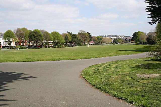
Image: © Tony Atkin Taken: 28 Apr 2006
This park used to be the upper part of the Stonehouse Creek tidal inlet ( Image ). It had been used as a tidal pond to power mills situated on a bridge across the creek close by where the photographer is standing. This area of town is today known as Millbridge. By the late 19th century this part of the creek was known as deadlake and was becoming a health hazard to local residents. After the very hot summer of 1887 efforts were started to fill in the creek and it was officially opened as a park in 1902.
Images are licensed for reuse under creativecommons.org/licenses/by-sa/2.0
Image Location
Latitude
50.37487
Longitude
-4.157252