Assarts Lane - Upper Welland Road junction
Introduction
The photograph on this page of Assarts Lane - Upper Welland Road junction by Bob Embleton as part of the Geograph project.
The Geograph project started in 2005 with the aim of publishing, organising and preserving representative images for every square kilometre of Great Britain, Ireland and the Isle of Man.

There are currently over 7.5m images from over 14,400 individuals and you can help contribute to the project by visiting https://www.geograph.org.uk
Assarts Lane - Upper Welland Road junction
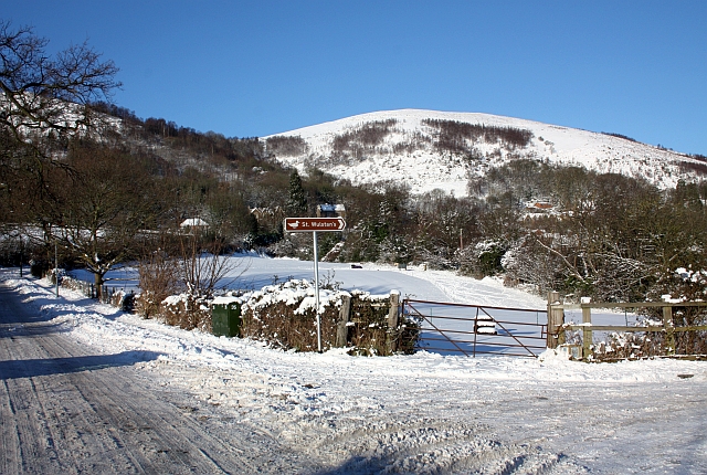
Image: © Bob Embleton Taken: 7 Jan 2010
The sign directs one down Assarts Lane to the old St Wulstan's hospital site that has been converted into expensive detached housing and a nature reserve. The field in the picture has been identified as possible future development land for housing. In the background is Pinnacle Hill.
Images are licensed for reuse under creativecommons.org/licenses/by-sa/2.0
Image Location


Leaflet Map data © OpenStreetMap
Latitude
52.068527
Longitude
-2.329944