Cwmbran Bus Station island
Introduction
The photograph on this page of Cwmbran Bus Station island by Jaggery as part of the Geograph project.
The Geograph project started in 2005 with the aim of publishing, organising and preserving representative images for every square kilometre of Great Britain, Ireland and the Isle of Man.

There are currently over 7.5m images from over 14,400 individuals and you can help contribute to the project by visiting https://www.geograph.org.uk
Cwmbran Bus Station island
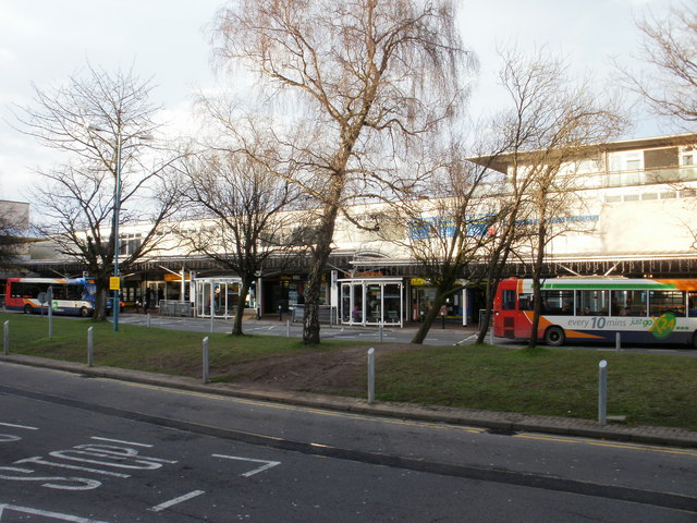
Image: © Jaggery Taken: 31 Dec 2009
The island is in the middle of the loop formed by Gwent Square in Cwmbran Bus Station. Prominent notices inform pedestrians that they must not use the island to cross from one side of the bus station to the other. Doing so would be dangerous because it involves crossing the two busy halves of the bus station roadway. The correct procedure is to use the pavement to walk around the horseshoe shaped bus station, but, predictably, some pedestrians prefer the quicker, dangerous route. The well-trodden track across the island is evidence of this. Behind the bus waiting areas on both sides of the bus station are shops and other business premises.
Images are licensed for reuse under creativecommons.org/licenses/by-sa/2.0
Image Location
Latitude
51.653837
Longitude
-3.021924