Stockingford Station (site of)
Introduction
The photograph on this page of Stockingford Station (site of) by Michael Westley as part of the Geograph project.
The Geograph project started in 2005 with the aim of publishing, organising and preserving representative images for every square kilometre of Great Britain, Ireland and the Isle of Man.

There are currently over 7.5m images from over 14,400 individuals and you can help contribute to the project by visiting https://www.geograph.org.uk
Stockingford Station (site of)
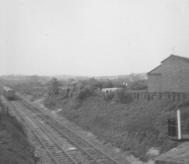
Image: © Michael Westley Taken: Unknown
View from Whittleford Road bridge down into cutting. Station was once where train is seen passing on its way to Birmingham. Stockingford is a suburb of Nuneaton and was once a heavy mining area. Surprising that more recent expansion of residential accommodation hasn't seen plans for recreation of station.
Images are licensed for reuse under creativecommons.org/licenses/by-sa/2.0
Image Location
Latitude
52.52324
Longitude
-1.509456