Eastbrook End Country Park and Dagenham Road
Introduction
The photograph on this page of Eastbrook End Country Park and Dagenham Road by John Rostron as part of the Geograph project.
The Geograph project started in 2005 with the aim of publishing, organising and preserving representative images for every square kilometre of Great Britain, Ireland and the Isle of Man.

There are currently over 7.5m images from over 14,400 individuals and you can help contribute to the project by visiting https://www.geograph.org.uk
Eastbrook End Country Park and Dagenham Road
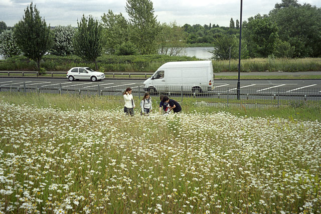
Image: © John Rostron Taken: 16 May 2004
On this occasion (May 2004), Eastbrook End Country park was a mass of wild flowers (admittedly with some encouragement from the park managers). This part of the park has been landscaped to produce a rolling terrain. Here students are studying the insects on the sward. In the background is one of the lakes on another part of the park, separated by Dagenham Road.
Images are licensed for reuse under creativecommons.org/licenses/by-sa/2.0
Image Location
Latitude
51.554977
Longitude
0.174222