Snow-laden road in Osmotherley
Introduction
The photograph on this page of Snow-laden road in Osmotherley by Philip Barker as part of the Geograph project.
The Geograph project started in 2005 with the aim of publishing, organising and preserving representative images for every square kilometre of Great Britain, Ireland and the Isle of Man.

There are currently over 7.5m images from over 14,400 individuals and you can help contribute to the project by visiting https://www.geograph.org.uk
Snow-laden road in Osmotherley
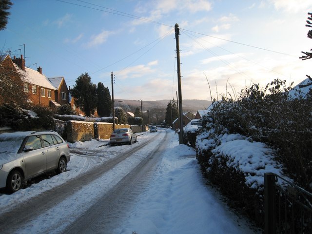
Image: © Philip Barker Taken: 3 Jan 2010
This picture shows a view of the road that leaves Osmotherly in a southerly direction from the village green. A little further south the road splits into two; the left (easterly) fork goes towards Chequers and the right fork (south) goes to Thimbleby. On the horizon a part of Thimbleby Bank Plantation can be seen.
Images are licensed for reuse under creativecommons.org/licenses/by-sa/2.0
Image Location
Latitude
54.365576
Longitude
-1.298007