Grand Union Canal: Silted up bay
Introduction
The photograph on this page of Grand Union Canal: Silted up bay by Nigel Cox as part of the Geograph project.
The Geograph project started in 2005 with the aim of publishing, organising and preserving representative images for every square kilometre of Great Britain, Ireland and the Isle of Man.

There are currently over 7.5m images from over 14,400 individuals and you can help contribute to the project by visiting https://www.geograph.org.uk
Grand Union Canal: Silted up bay
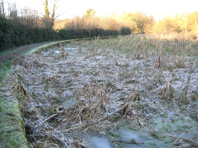
Image: © Nigel Cox Taken: 1 Jan 2010
The towpath side of the canal makes a large semi-circular bay just to the north of Image The bay appears to have silted up over time and although boat-users would probably pass it by without realising its presence, it makes a large deviation away from the canal for towpath walkers and cyclists. It appears to be too large for a canal narrowboat turning bay, so what was its purpose? The only clue comes from the older editions of the large scale Ordnance Survey mapping. The 1883 version shows a rectangular building described as a mill (plus some other but indecipherable words), in the centre of the bay. Later editions refer to the building, which has long since been demolished, as a pumping house. On the first day of the new decade the shadow of the motorway embankment above it had prevented any sun from reaching most of it and the water and reeds remain resolutely frozen hard.
Images are licensed for reuse under creativecommons.org/licenses/by-sa/2.0
Image Location
Latitude
51.683899
Longitude
-0.433553