Towards Walton-on-Thames
Introduction
The photograph on this page of Towards Walton-on-Thames by Ian Capper as part of the Geograph project.
The Geograph project started in 2005 with the aim of publishing, organising and preserving representative images for every square kilometre of Great Britain, Ireland and the Isle of Man.

There are currently over 7.5m images from over 14,400 individuals and you can help contribute to the project by visiting https://www.geograph.org.uk
Towards Walton-on-Thames
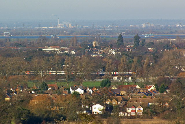
Image: © Ian Capper Taken: 1 Jan 2010
Viewed from the top of Belvedere Tower, Claremont Landscape Garden (see Image). The houses in the foreground are in Hersham, with the nearest ones being in Old Esher Road, fronting on to the River Mole. The railway is the South Western mainline out of London Waterloo towards Woking, with the train visible being on a southbound South West Trains service having just passed through Hersham Station. Beyond is Walton-on-Thames, with the tower of St Mary's Church prominent. The large expanse of water is the Queen Mary Reservoir, one of a chain of reservoirs south of Heathrow Airport. In the far distance is Slough Power Station, a biomass power station on Slough Trading Estate (see Image).
Images are licensed for reuse under creativecommons.org/licenses/by-sa/2.0
Image Location
Latitude
51.368463
Longitude
-0.390453