Pre-Worboys sign, Whitehead
Introduction
The photograph on this page of Pre-Worboys sign, Whitehead by Albert Bridge as part of the Geograph project.
The Geograph project started in 2005 with the aim of publishing, organising and preserving representative images for every square kilometre of Great Britain, Ireland and the Isle of Man.

There are currently over 7.5m images from over 14,400 individuals and you can help contribute to the project by visiting https://www.geograph.org.uk
Pre-Worboys sign, Whitehead
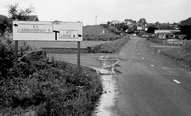
Image: © Albert Bridge Taken: 6 Jul 1980
A pre-Worboys sign on the Slaughterford Road, leading to the main road. The crossroads Image had still to be re-built. The Rawbrae service station is at top right and still looks much the same.
Images are licensed for reuse under creativecommons.org/licenses/by-sa/2.0
Image Location
Latitude
54.758789
Longitude
-5.720173