Queen's Park railway station
Introduction
The photograph on this page of Queen's Park railway station by Thomas Nugent as part of the Geograph project.
The Geograph project started in 2005 with the aim of publishing, organising and preserving representative images for every square kilometre of Great Britain, Ireland and the Isle of Man.

There are currently over 7.5m images from over 14,400 individuals and you can help contribute to the project by visiting https://www.geograph.org.uk
Queen's Park railway station
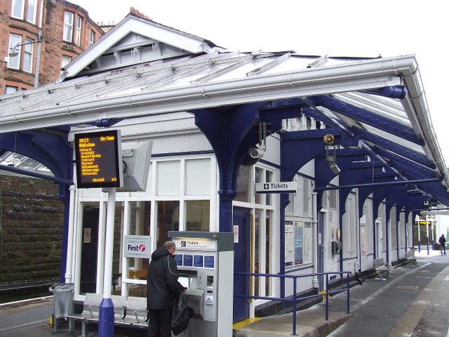
Image: © Thomas Nugent Taken: 30 Dec 2009
A traditional island platform station on the Catchart Circle, between Pollokshields East and Crosshill stations. Queen's Park is also served by the Neilston and Newton services.
Images are licensed for reuse under creativecommons.org/licenses/by-sa/2.0
Image Location
Latitude
55.835346
Longitude
-4.266832