Croydon: Tamworth Road
Introduction
The photograph on this page of Croydon: Tamworth Road by Dr Neil Clifton as part of the Geograph project.
The Geograph project started in 2005 with the aim of publishing, organising and preserving representative images for every square kilometre of Great Britain, Ireland and the Isle of Man.

There are currently over 7.5m images from over 14,400 individuals and you can help contribute to the project by visiting https://www.geograph.org.uk
Croydon: Tamworth Road
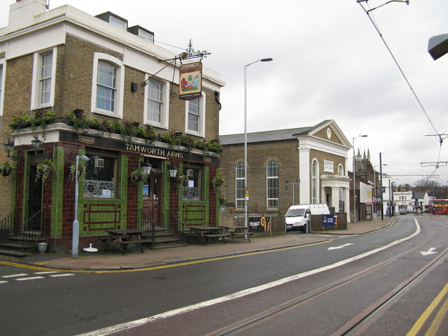
Image: © Dr Neil Clifton Taken: 31 Dec 2009
Looking south-west, the 'Tamworth Arms' can be seen on the left, while further along the road is the Baptist Chapel of 1866. In the distance is the tower of the Parish Church.
Images are licensed for reuse under creativecommons.org/licenses/by-sa/2.0
Image Location
Latitude
51.375012
Longitude
-0.104451