Out of Banks
Introduction
The photograph on this page of Out of Banks by Des Blenkinsopp as part of the Geograph project.
The Geograph project started in 2005 with the aim of publishing, organising and preserving representative images for every square kilometre of Great Britain, Ireland and the Isle of Man.

There are currently over 7.5m images from over 14,400 individuals and you can help contribute to the project by visiting https://www.geograph.org.uk
Out of Banks
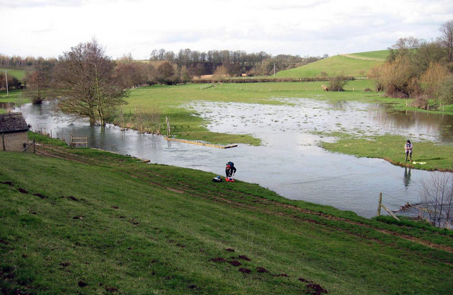
Image: © Des Blenkinsopp Taken: 15 May 2009
A spot of localised flooding on the River Glyme. The structure is an Environment Agency flow gauging station, where the flow is automatically recorded and my colleagues are taking measurements to ensure the calibration of the gauge is correct in such high flows. This photo is dated 15th May, but I suspect that's a download date, Guessing March /early April.
Images are licensed for reuse under creativecommons.org/licenses/by-sa/2.0
Image Location
Latitude
51.863679
Longitude
-1.356188