Grove Street and former Wesleyan school
Introduction
The photograph on this page of Grove Street and former Wesleyan school by Andrew Hill as part of the Geograph project.
The Geograph project started in 2005 with the aim of publishing, organising and preserving representative images for every square kilometre of Great Britain, Ireland and the Isle of Man.

There are currently over 7.5m images from over 14,400 individuals and you can help contribute to the project by visiting https://www.geograph.org.uk
Grove Street and former Wesleyan school
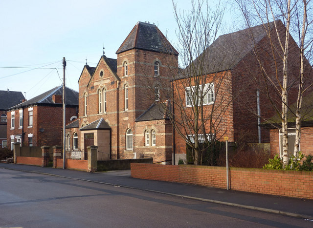
Image: © Andrew Hill Taken: 28 Dec 2009
The large church closer to town and the school (the building with the distinctive roofline) show the large presence the Methodist movement had within the town of Retford. The school is now a business premises.
Images are licensed for reuse under creativecommons.org/licenses/by-sa/2.0
Image Location
Latitude
53.322187
Longitude
-0.938268