Former railway viaduct over Timber Lane
Introduction
The photograph on this page of Former railway viaduct over Timber Lane by P L Chadwick as part of the Geograph project.
The Geograph project started in 2005 with the aim of publishing, organising and preserving representative images for every square kilometre of Great Britain, Ireland and the Isle of Man.

There are currently over 7.5m images from over 14,400 individuals and you can help contribute to the project by visiting https://www.geograph.org.uk
Former railway viaduct over Timber Lane
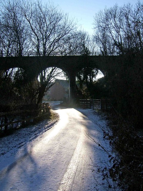
Image: © P L Chadwick Taken: 25 Dec 2009
Part of the long viaduct, which used to carry the railway line that ran through Stourport-on-Severn. Today it carries a public bridleway instead, and part of this is known as Leapgate Country Park. Through the arch under which Timber Lane passes, can be glimpsed some of the new housing recently built on the other side of the viaduct. This scene was photographed on Christmas Day morning, when snow was still on the ground. Unfortunately photographing directly into the sun has lost a lot of shadow detail. Image
Images are licensed for reuse under creativecommons.org/licenses/by-sa/2.0
Image Location
Latitude
52.344697
Longitude
-2.26506