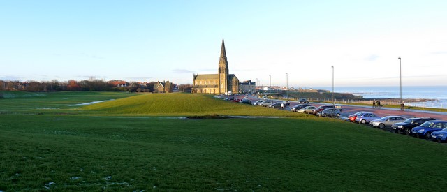
The Links, Grand Parade, Tynemouth
Introduction
The photograph on this page of The Links, Grand Parade, Tynemouth by Andrew Curtis as part of the Geograph project.
The Geograph project started in 2005 with the aim of publishing, organising and preserving representative images for every square kilometre of Great Britain, Ireland and the Isle of Man.
There are currently over 7.5m images from over 14,400 individuals and you can help contribute to the project by visiting https://www.geograph.org.uk

Image: © Andrew Curtis Taken: 26 Dec 2009
An open space between Tynemouth, north of the Blue Reef Aquarium Image, and Cullercoates. St George's Church is in the centre of the panorama Image Beaconsfield House used to stand here. It was a seafront villa built in c.1882 by coal-owner and philanthropist John Henry Burn and named after Lord Beaconsfield. Mr Burn died in 1898 but his widow continued to live there until 1922 when it became a Dr. Barnado's Children's Home http://www.goldonian.org/photos/photo_archive_homes/pages/beaconsfield.htm In 1953 it was purchased by Tynemouth Council for use as a convalescent home. The house was finally demolished in 1959 and plans for a multi-storey hotel and leisure complex were never carried out. Tyne and Wear HER (8660): Cullercoats, Beaconsfield House http://www.twsitelines.info

