Whitley Links
Introduction
The photograph on this page of Whitley Links by Andrew Curtis as part of the Geograph project.
The Geograph project started in 2005 with the aim of publishing, organising and preserving representative images for every square kilometre of Great Britain, Ireland and the Isle of Man.

There are currently over 7.5m images from over 14,400 individuals and you can help contribute to the project by visiting https://www.geograph.org.uk
Whitley Links
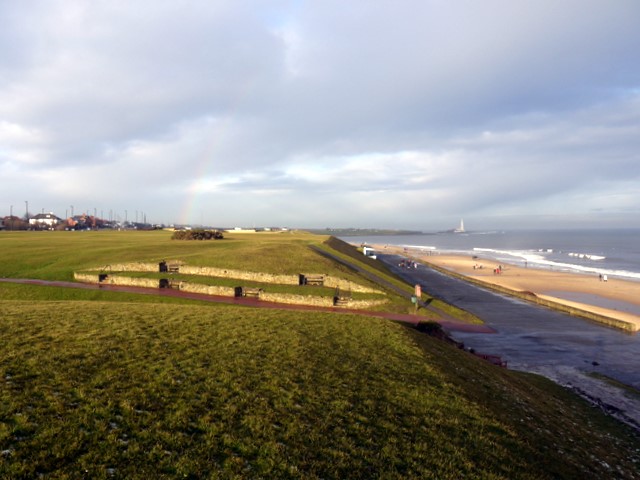
Image: © Andrew Curtis Taken: 26 Dec 2009
The low afternoon sun is picking out Whitley Sands and the distant lighthouse on St Mary's Island. Early in the 1800s, the Links were strewn with colliery heaps and ironstone workings which became overgrown with gorse. The smoother ground and short turf here now was partially a result of clearances for Whitley Golf Course founded in 1890.
Images are licensed for reuse under creativecommons.org/licenses/by-sa/2.0
Image Location
Latitude
55.056468
Longitude
-1.453165