Betchworth Bridge
Introduction
The photograph on this page of Betchworth Bridge by Ian Capper as part of the Geograph project.
The Geograph project started in 2005 with the aim of publishing, organising and preserving representative images for every square kilometre of Great Britain, Ireland and the Isle of Man.

There are currently over 7.5m images from over 14,400 individuals and you can help contribute to the project by visiting https://www.geograph.org.uk
Betchworth Bridge
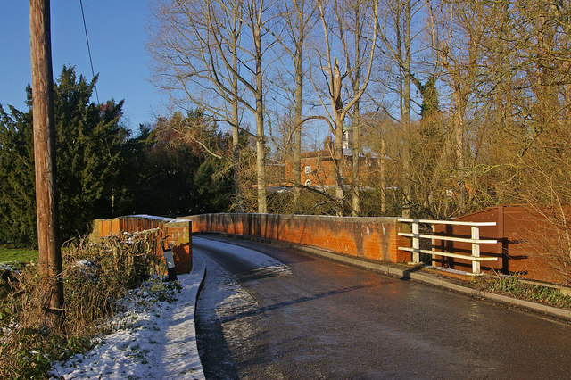
Image: © Ian Capper Taken: 20 Dec 2009
Spanning the River Mole, this single track bridge was built in 1842 and strengthened and refurbished in 1993. Through the trees can be seen part of the Grade II* listed Betchworth House. For listing particulars see www.historicengland.org.uk/listing/the-list/list-entry/1028786.
Images are licensed for reuse under creativecommons.org/licenses/by-sa/2.0
Image Location
Latitude
51.231752
Longitude
-0.265399