Milestone, Leasingham
Introduction
The photograph on this page of Milestone, Leasingham by Alan Murray-Rust as part of the Geograph project.
The Geograph project started in 2005 with the aim of publishing, organising and preserving representative images for every square kilometre of Great Britain, Ireland and the Isle of Man.

There are currently over 7.5m images from over 14,400 individuals and you can help contribute to the project by visiting https://www.geograph.org.uk
Milestone, Leasingham
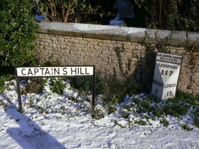
Image: © Alan Murray-Rust Taken: 20 Dec 2009
Early 19th cast iron milestone on the main road through Leasingham. The English Heritage listing suggests that it has been moved from the opposite side of the road because Lincoln (to the north) is shown on the south face, and Sleaford vice versa. However, the normal practice on triangular milestones is for the facing side to show the place towards which the oncoming traveller is facing. The milestone is shown at this position on the 1905 1:2500 map, which certainly suggests that it is in its original location. Listed grade II.
Images are licensed for reuse under creativecommons.org/licenses/by-sa/2.0
Image Location
Latitude
53.023739
Longitude
-0.426753