Kenlis Street and Rathfriland Road, Banbridge
Introduction
The photograph on this page of Kenlis Street and Rathfriland Road, Banbridge by Dean Molyneaux as part of the Geograph project.
The Geograph project started in 2005 with the aim of publishing, organising and preserving representative images for every square kilometre of Great Britain, Ireland and the Isle of Man.

There are currently over 7.5m images from over 14,400 individuals and you can help contribute to the project by visiting https://www.geograph.org.uk
Kenlis Street and Rathfriland Road, Banbridge
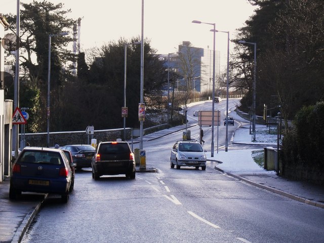
Image: © Dean Molyneaux Taken: 21 Dec 2009
The view down Kenlis Street from outside Mills' coal stores. The little roundabout in the centre regulates traffic appeared in order to ease congestion for traffic leaving Tesco's. The main Rathfriland Road continues towards the creamery and the A1 Bypass.
Images are licensed for reuse under creativecommons.org/licenses/by-sa/2.0
Image Location
Latitude
54.345738
Longitude
-6.266478