West Coastway Line
Introduction
The photograph on this page of West Coastway Line by Simon Carey as part of the Geograph project.
The Geograph project started in 2005 with the aim of publishing, organising and preserving representative images for every square kilometre of Great Britain, Ireland and the Isle of Man.

There are currently over 7.5m images from over 14,400 individuals and you can help contribute to the project by visiting https://www.geograph.org.uk
West Coastway Line
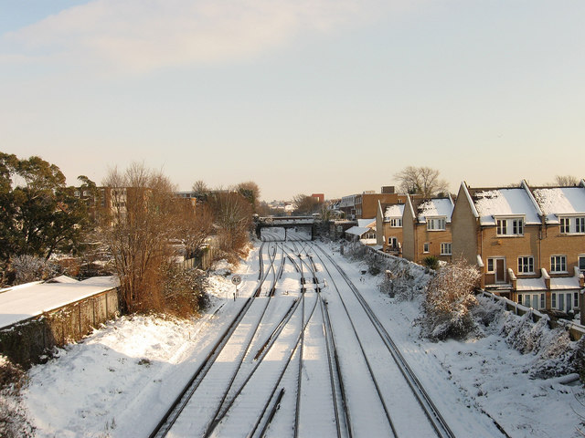
Image: © Simon Carey Taken: 18 Dec 2009
Opposite view of Image taken from Drive Bridge and looking towards Wilbury Villas Bridge. Beyond the bridge is the junction with the Cliftonville Spur which heads north to Preston Park station and the main London-Brighton line. The houses on the right are in Cambridge Mews built a few years ago on the site of an old parcel depot.
Images are licensed for reuse under creativecommons.org/licenses/by-sa/2.0
Image Location
Latitude
50.834241
Longitude
-0.165357