Greyfriars
Introduction
The photograph on this page of Greyfriars by Simon Carey as part of the Geograph project.
The Geograph project started in 2005 with the aim of publishing, organising and preserving representative images for every square kilometre of Great Britain, Ireland and the Isle of Man.

There are currently over 7.5m images from over 14,400 individuals and you can help contribute to the project by visiting https://www.geograph.org.uk
Greyfriars
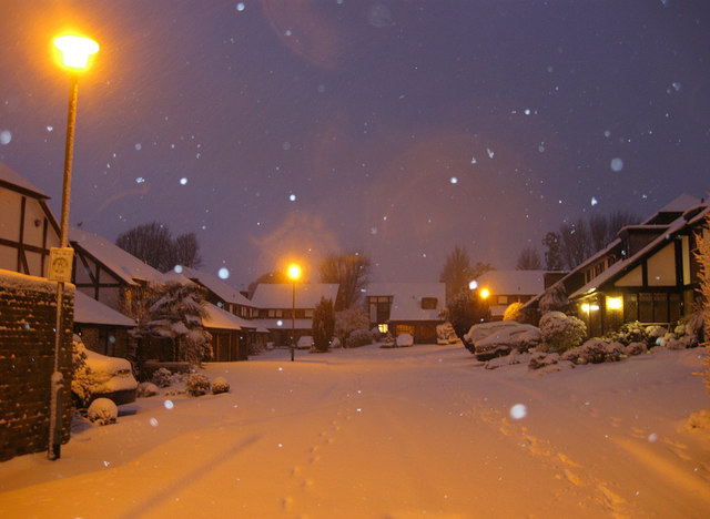
Image: © Simon Carey Taken: 18 Dec 2009
Recently built cul-de-sac off The Upper Drive, see Image for a view without snow. The snow arrived in Brighton on Thursday night though did not start to settle in earnest until gone 11pm, by this time, 7.25am it was ankle deep and still snowing as can be seen by the flash of the camera reflecting in the falling snow. Snowing finally ceased around 8.30am.
Images are licensed for reuse under creativecommons.org/licenses/by-sa/2.0
Image Location
Latitude
50.837922
Longitude
-0.159248