On top of Whittington Tump or Crookbarrow Hill
Introduction
The photograph on this page of On top of Whittington Tump or Crookbarrow Hill by Philip Halling as part of the Geograph project.
The Geograph project started in 2005 with the aim of publishing, organising and preserving representative images for every square kilometre of Great Britain, Ireland and the Isle of Man.

There are currently over 7.5m images from over 14,400 individuals and you can help contribute to the project by visiting https://www.geograph.org.uk
On top of Whittington Tump or Crookbarrow Hill
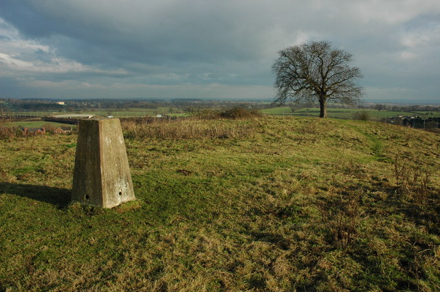
Image: © Philip Halling Taken: 13 Dec 2009
View to the north-east from the trig point on top of Whittington Tump or Crookbarrow Hill. A bridge over the M5 motorway can be seen above the trig point, with the sun lighting Spetchley Hall in the distance. With its tree on the summit this 86m high hill is a prominent feature for travellers passing junction 7 on the M5 motorway. There is still debate as to whether this is a natural or man-made hill. There is a myth that it is a burial site from the Battle of Worcester (1651), however, some archaeologists believe it may be a very large ancient burial barrow. No archaeology dig has ever taken place on the site.
Images are licensed for reuse under creativecommons.org/licenses/by-sa/2.0
Image Location
Latitude
52.168819
Longitude
-2.184912